In the U.S., the National Equipment Register (NER) estimates that $300 million to $1 billion worth of construction and farm equipment is stolen each year — and tractors are among the top stolen items.
Problem Statement
Farmers using telemetric-enabled Kubota equipment require a mobile-ready solution to easily manage fleet GPS locations and machine maintenance, making it difficult to prevent theft, effectively manage crews, and stay on-time with manufacturer recommended maintenance schedules.
Contextual Research
As an urban-based team, none of us had worked on a farm, nor had we previously owned and operated industrial farming equipment. So, we needed to get up to speed, fast.
We visited farms and equipment vendors to immerse, empathize, and learn firsthand from users and sellers about pain points, needs, and wants.


Pain points
One of the major problems which we were surprised to learn about, was theft.
Large tractors are highly valuable and can be difficult to secure and track within the boundaries of a large area.
Pain points
Another pain point was keeping up with complicated maintenance schedules, and the tedium of performing the maintenance.
Performing maintenance was a manual exercise often requiring the farmer to contact his dealer, or search through large databases to find the most relevant walkthrough.

Market Research
It's always good to have a sense of the marketplace of similar applications, to spark ideas, steer clear of copying, and build a sense of familiarity based on applications the user may have used previously.
For example, we found some good reference points for geo-tracking and maintenance notifications in apps by Bobcat and John Deere, while noticing there were still many feature gaps and opportunities in the market to address.

User Segmentation
We needed to consider three different user types: Light, Heavy, and Dealers, each with unique needs.

Feature Mapping
Taking the learnings from user and market research, balancing against business requirements and technical feasibility, we road-mapped and prioritized a set of features to build.

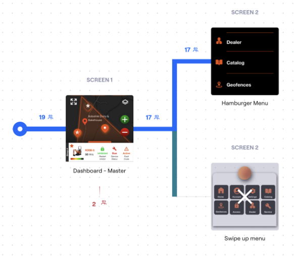
User Flow Diagramming
Breaking down each step of the product's interaction into individual elements, helps reveal opportunities for design improvements.

Collaborative Wireframing
We used a tool called Miro to begin iterating in low fidelity to avoid the problem of "building the wrong thing" later in the design process.

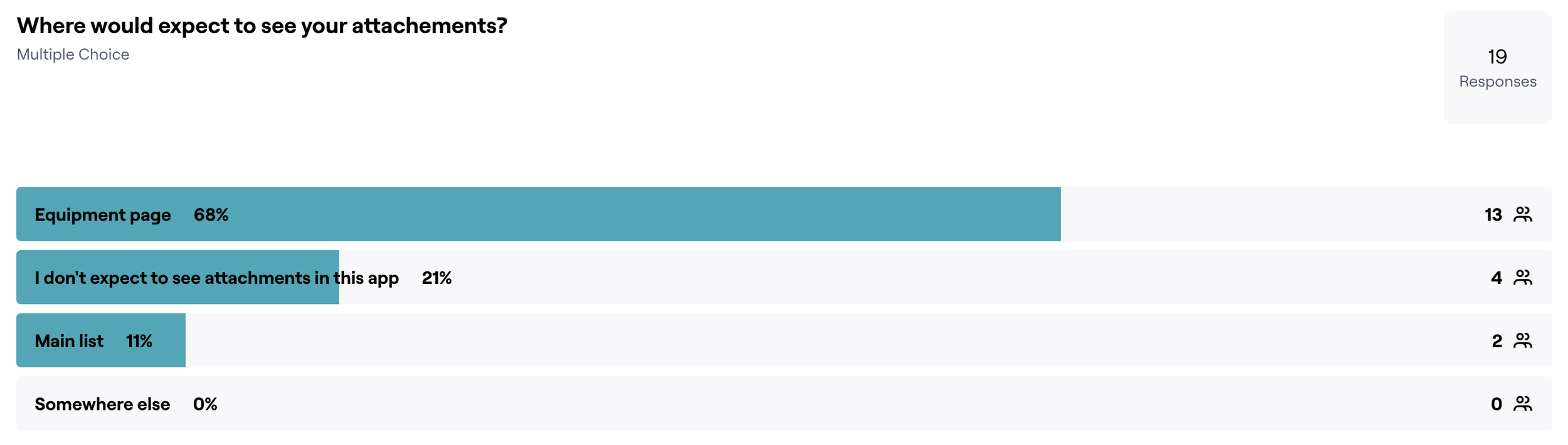
User Surveys
When in doubt about "where", "how", or "if" a product feature should be implemented -- ask the users!
Solution: First login walkthrough
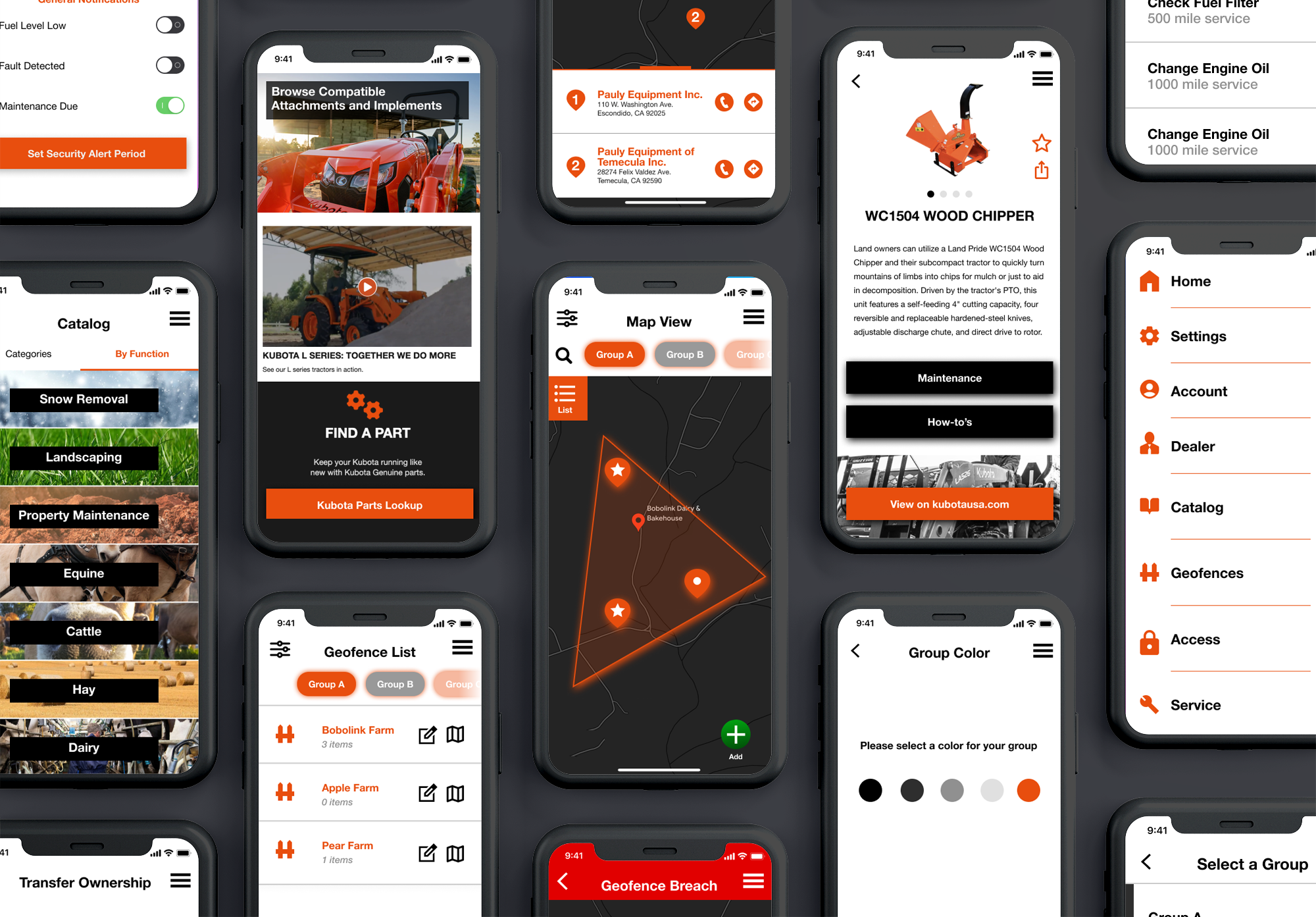
One of the problems we heard about in reviews of similar apps, was that it was "unclear which functions can be performed on this app", as well as a need for an "easy way to add equipment". To address this we provided three different means of adding equipment, via serial, catalog, or QR Code.

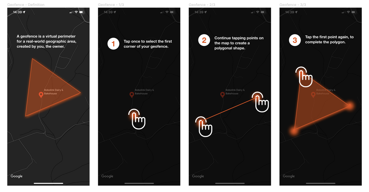
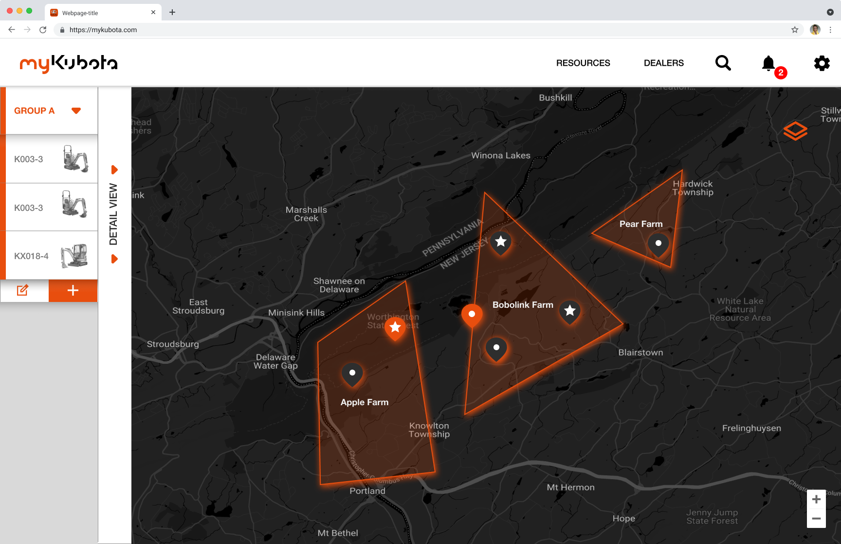
Solution: Geofences
"Geofences" were a solution we came up with to address the problems around theft and fleet management. Below is the first-time-use user walk-through to create a geofence in the map view.
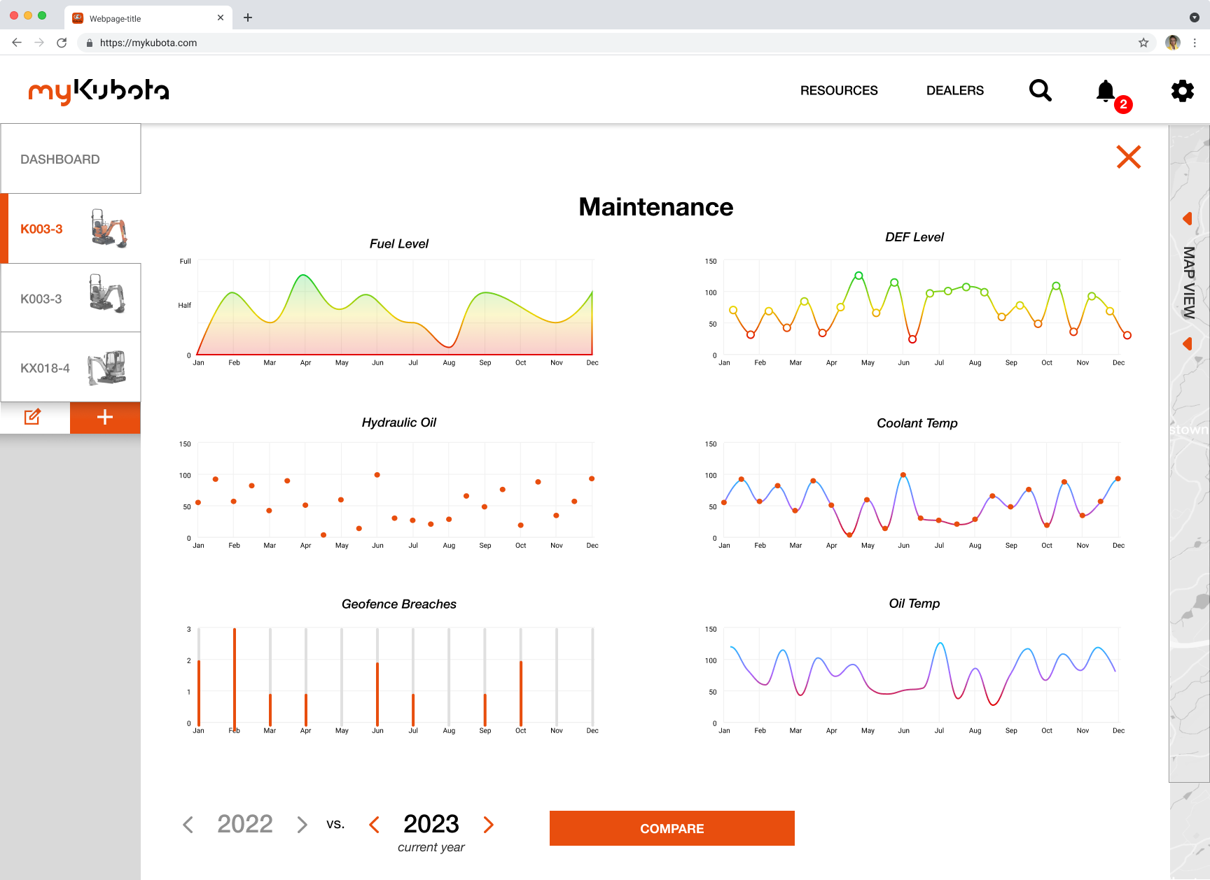
Solution: Service Timeline
The service timeline meets a triple-part need: the ability to view past service, current "due service", and upcoming schedules to plan accordingly.

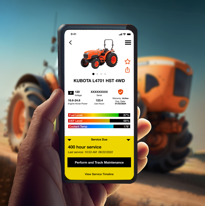
Solution: Equipment Page
One of the most complex screens was the ‘My Equipment’ page, which required viewability of the most critical metrics, available at a glance, with the ability to drill into a detailed view.
User Testing and Surveys
User testing with clickable "looks-like, works like" prototypes allowed us to connect with users pre-development for feedback and validation.
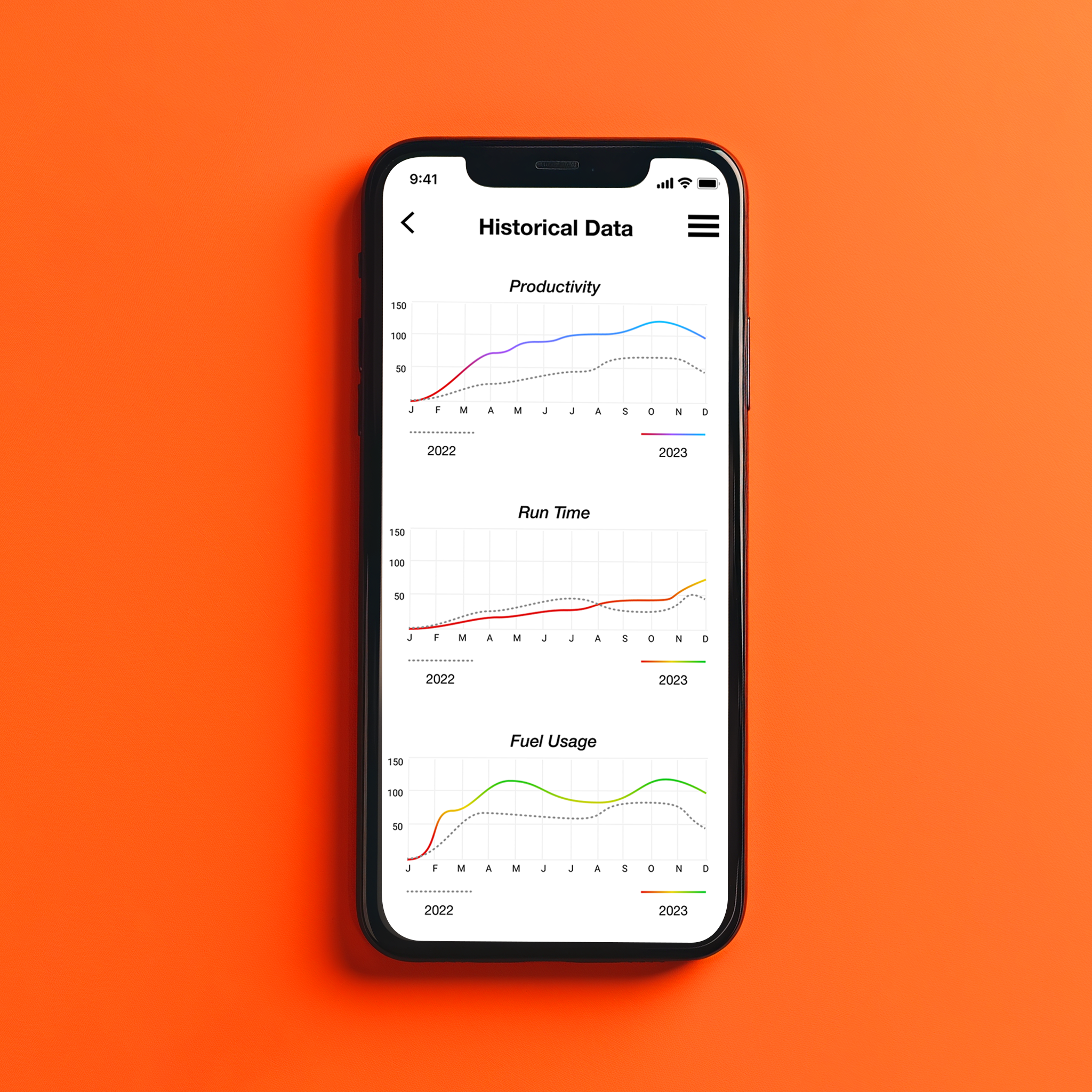
Solution: Historical Data
We were told by farmers that the most important problem to solve was the viewability of historical usage data, which helps the farmer to optimize overall productivity, keep costs low, and even detect possible equipment theft. We made sure to give this screen extra attention and capability.
Desktop Version
We created mockups to guide design of the desktop version of the app, which some farmers expressed an interest in using. The desktop view provides more screen real estate and quicker multi-tasking.
Desktop Version: Mapview
Of particular usefulness is the map view in the desktop version. Our testing showed users preferred to create and manage geofences on a desktop or tablet, while view-only on mobile was more likely.
Final Product
The final product reflects an on-brand appearance, with features like "Geo-Fencing" that solve real user pain points and enhance existing capabilities. The redesign launch is scheduled for mid-2025.
Selected Works
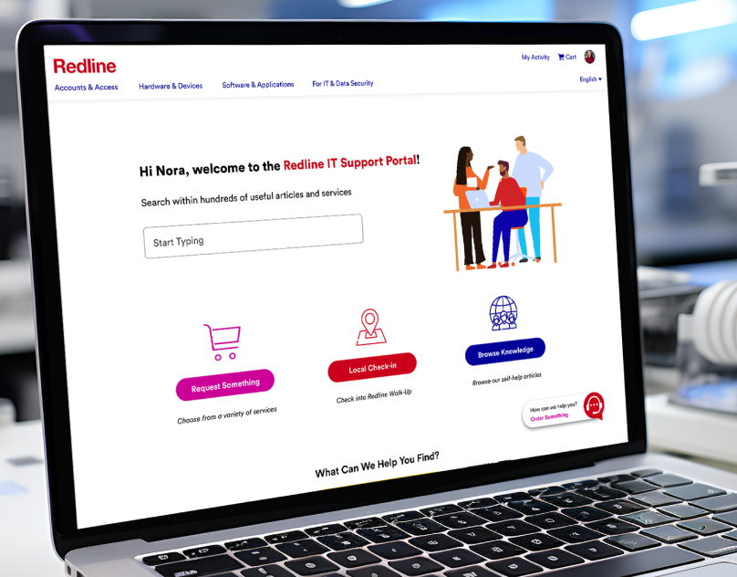
Redline IT Support PortalServiceNow IT Support Portal
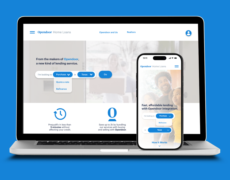
Opendoor Home Loans ExperienceUX Design
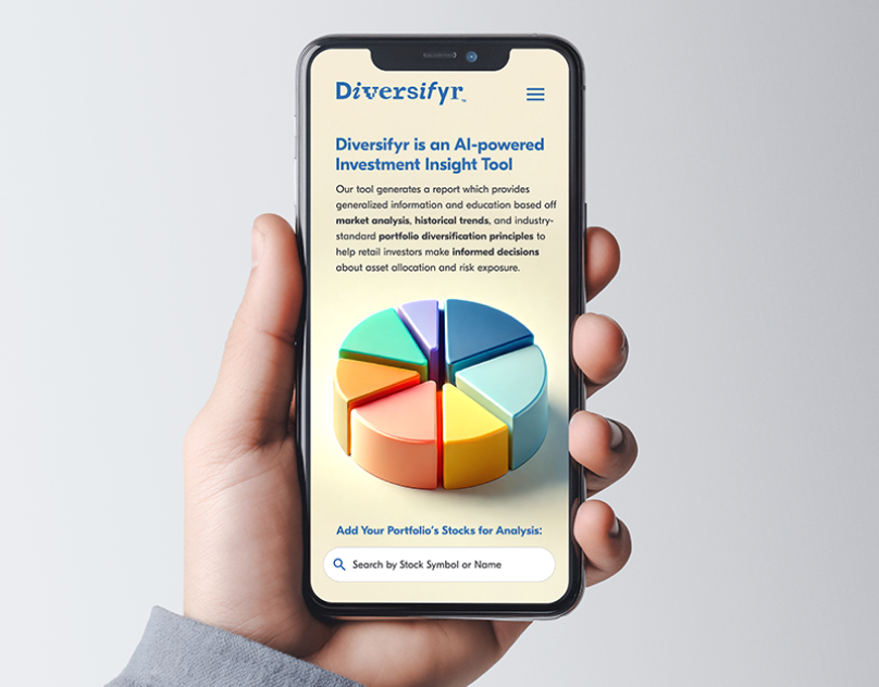
Diversifyr AI Fintech ToolFinTech
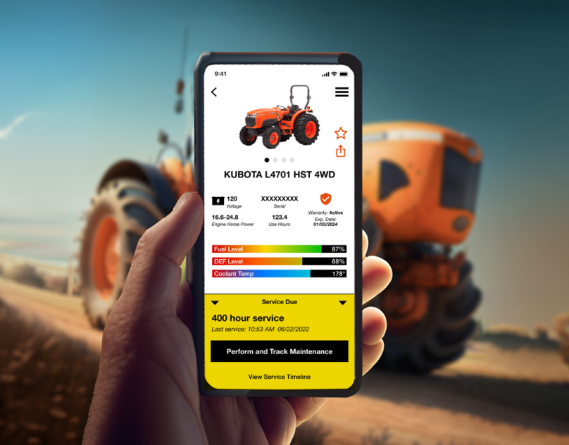
MyKubota Telemetric AppNative Mobile App Design
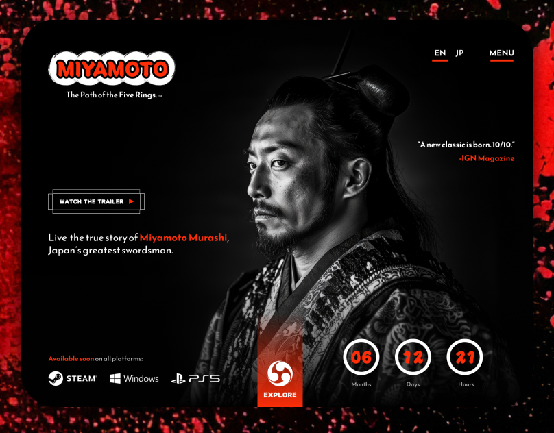
Miyamoto Video Game TeaserVideo Game Teaser Site
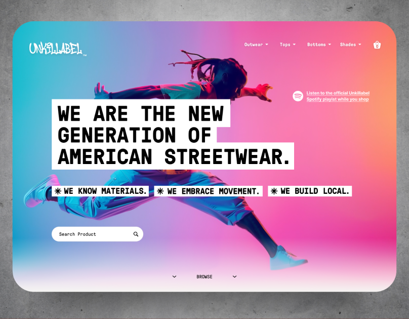
Unkillable Ecommerce ConceptRetail E-commerce